Wind causes wildfires to grow in Southeast Fire Centre
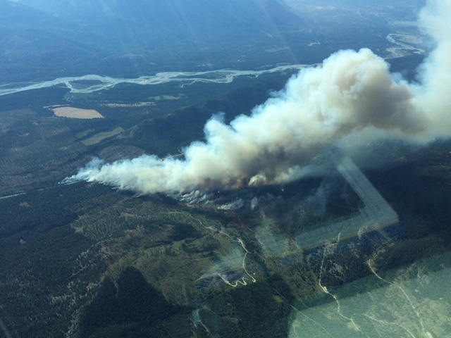
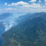
The Southeast Fire Centre said in a media release Monday that current weather conditions in the region are having an impact on wildfires with wind activity causing the size of several fires to grow on Sunday, July 30, 2017.
Island Pond wildfire
- The 150-hectare Island Pond fire that started on July 30 is about 17 kilometres southeast of Canal Flats.
- As of the afternoon of July 31, three helicopters, airtankers and heavy equipment are supporting 33 firefighting personnel on the ground. Crews are building fire guards to help contain this fire.
Rapid Creek wildfire
- As of the afternoon of July 31, the Rapid Creek wildfire is estimated to cover 300 hectares. This fire is about four kilometres southwest of Highway 31 and about 27 kilometres northwest of Meadow Creek.
- BC Wildfire Service crews are monitoring this fire and will be sending in heavy equipment to help ground crews create a fire break between the fire and the community. At this time, there is no threat to residents or visitors in the area.
- As a precautionary measure, the Regional District of Central Kootenay has issued an evacuation alert for the Poplar Creek area. Details about this evacuation alert are available on the district’s website at: http://www.rdck.ca/
Harrop Creek wildfire
- The Harrop Creek wildfire is about 10 kilometres south of the communities of Harrop and Procter. As of the afternoon of July 31, it is estimated to cover 200 hectares and some growth has occurred on the fire’s east flank.
- Ground crews (supported by aircraft and heavy equipment) are working on this fire.
- Heavy equipment will be moving across Harrop Creek on July 31 to start constructing fire guards. The water should not be affected by this activity and measures are being taken to ensure minimal disturbance to the creek.
Glacier Creek wildfire
- The Glacier Creek wildfire is about 26 kilometres northeast of Copper Creek. As of the afternoon of July 31, it is estimated to cover 70 hectares.
- Recent growth of this fire resulted in a Road Restriction being placed on the Duncan-Glacier Creek Forest Service Road, starting at the MacBeth Icefields turnoff at the 19-kilometre mark. A map indicating the area affected by this road restriction is available online at: http://ow.ly/ccaN30e3NZz
John Boivin, Information Officer with the Southeast Fire Centre said fire activity and fire behaviour can change quickly, so members of the public are urged to remain vigilant and be extremely careful with any activity that could potentially spark a new wildfire.
“The combination of complex terrain, remote location and aggressive fire behavior has created unsafe working environments for ground crews on some wildfires in the Southeast Fire Centre,” Boivin explained.
“These “modified response” fires continue to be monitored from the air to ensure that they remain within a specific area and meet land management guidelines. It is important to remember that wildfire can be beneficial for ecosystems and, where infrastructure or communities are not threatened, it may be more appropriate to let the wildfire burn.”
The Southeast Fire Centre extends from the U.S. border in the south to the Mica Dam in the north and from the Okanagan Highlands and Monashee Mountains in the west to the B.C.-Alberta border in the east. The Southeast Fire Centre includes the Selkirk Natural Resource District and the Rocky Mountain Natural Resource District.
To report a wildfire or open burning violation, call *5555 on a cellphone or 1 800 663-5555 toll-free. For the latest information on current wildfire activity, burning restrictions, road closures and air quality advisories, visit: www.bcwildfire.ca
You can also follow the latest wildfire news:
* On Twitter: http://twitter.com/BCGovFireInfo


