UPDATED: Environment Canada continues Special Weather Statement; up to 30 cm expected on Kootenay Pass

By Nelson Daily Staff
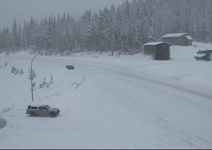
While Environment Canada continues its Special Weather Statement for the Southern Interior, Marc Dale Operations Manager for the Yellowhead Road & Bridge Ltd. Southeast Kootenay Division said drivers of the Kootenay Pass should brace for 20-30 cm of heavy wet snow above 800 meters and snow levels rising overnight to 1500 meters as temperatures warm overnight.
“High elevation passes such as Kootenay Pass will be experiencing a winter weather event tonight and through Friday with this system tapering off late Friday,” Dale said in a media release.
“All travelers over Kootenay Pass will experience winter driving conditions tonight and all day Friday please use caution, allow extra time if you must travel and leave extra space between you and the vehicle ahead of you.”
Dale said drivers should expect changing weather conditions at higher elevation, limited visibility due to snow or fog and winter driving conditions on most mountain highways.
Meanwhile, Environment Canada said the powerful storm will move across in the British Columbia Interior Thurday and into the night.
“The system will race through the Central Interior this afternoon and then stall across the south interior tonight,” the Weather Statement said.
“Strong winds with gusts over 70 km/h have developed across the Central Interior this morning and will spread southward this afternoon.
The storm may linger over the far southern part of the province on Friday producing a prolonged period of heavy precipitation.
Dale is asking drivers to please allow plenty of room for plow trucks or snow removal equipment to operate.
YRB will have full resources on the road around the clock patrolling, plowing and sanding highways.
Drivers should check Drive BC for weather and road conditions prior to travelling and call YRB’s direct line at 1-888-352-0356 if you see any problems that require our immediate attention.
Environment Canada issues Special Weather Statement
Environment Canada has issued a Special Weather Statement that a powerful storm will hit British Columbia on Thursday.
Environment Canada said the cold front will race across the Central Interior Thursday afternoon and then stall across the Southern Interior in the evening.
“Strong winds with gusts over 70 km/h will develop across the Central Interior in the morning then spread to the Southwest Interior in the afternoon,” the Weather Statement said.
Environment Canada said locally heavy precipitation will also accompany the front with snow will develop over the Columbia regions in the morning and then spread to the Kootenays.
“Rising freezing levels, however, will cause the snow to change to rain over most of the Kootenay regions in the afternoon,” the Weather Statement said.
“The storm may linger over the far southern part of the province on Friday, in which case, potentially heavy precipitation would continue.”
Environment Canada said the public is advised to monitor future forecasts and warnings as warnings may be required or extended.
For more information the public is urged to monitor the latest forecasts and warnings from Environment Canada at www.weather.gc.ca.
Story originate at The Nelson Daily