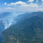
Paulson Pass closed due to fire; Rock Creek residents return home; Stickpin fire burns on
Update: Both lanes of the Paulson pass were opened late Tuesday night.
Updated: The Paulson Pass is expected to be opened single lane around 11 p.m. tonight
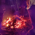
Original: A fire on the Paulson Pass east of Christina Lake has caused Hwy 3 to be closed from Christina Lake to the junction with Hwy 3B at Nancy Greene Lake, Aug. 18.
The fire has been burning at a moderate place since Thursday, Aug. 13 and is estimated to be 260 hectares (642 acres).
According to the BC Wildfire Service, this is not an interface fire – a fire that puts people or communities at risk. However, the fire was moving downhill toward the highway, making closure necessary.
There are 30 firefighters battling this fire, two helicopters and six pieces of heavy equipment. It is zero per cent contained.
There is no timeframe for when the highway will reopen.
Rock Creek Fire
The Rock Creek fire continues to burn and is still estimated to be 3,905 hectares (9649 acres) but the evacuees have been taken back into the area.
The BC Wildfire Service has confirmed that 30 homes have been lost to this fire and an additional 15 structures.
An evacuation alert is still in effect in the following areas:
- East and north of the Kettle River and south of the North-East boundary of Kettle River Provincial Park described in more detail below has, therefore, been rescinded:
- Kettle River East Road
- Nicholson Creek Road
- Kettle Valley South Road;
- South side of the Kettle River to the bridge crossing the Kettle River at Rock Creek, and then along the south side of Rock Creek Cut-off Road and Hwy 3; and
- All residents on Hulme Creek Road (access limited to residents only).
The original evacuation order was rescinded and changed to an alert at 4 p.m. today.
According to FortisBC power was restored to the Christian Valley at 7 p.m. Aug. 17 using diesel-generated power. However, power from Westbridge to Rock Creek is expected to take two weeks due to extensive damage.
Power was returned to Beaverdell on Aug. 15, and to Rock Creek, Kettle Valley South Road, Kettle Valley Road and Bridesville Mount Baldy on Aug. 14
No deaths have been reported from this fire.
Washington/Stickpin Fire
The Stickpin fire burning south of Grand Forks has been grouped into four fires burning in Northern Washington’s Ferry Country. The four fires are called the Kettle Complex with the Stickpin Fire continuing to burn at 15317.4 hectares (37,850 acres), with the northern part of the fire estimated to be 6 to 7 km south of the Canadian border.
Smoke and occasionally flames are visible by South Boundary residents who collected ash and burnt branches from their yards over the weekend
Over 400 US firefighters are working at preserving structures and setting up fire lines to help control the fire, which is still zero per cent contained.
They are using dozer and hand line construction in the Boulder Creek and Long Alec Creek areas.
The Southeast Fire Centre is aware of this fire but the only action they can take until it crosses the Canadian borderline is preventative. They have been doing controlled burns to get rid of any wood or fuel that would encourage the fire to spread north. The US fire service expects the Kettle Complex fires to grow over the next few days as hot, dry weather is forecast.


