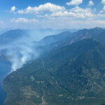
Washington fire 6 km from Canadian border

By Boundary Sentinel
Edited to add: The BC Wildfire Service plans on — and may have started — doing controlled burning called “burning operations” to help control the blaze if it does cross into Canada. Some smoke in that area may be due to the controlled burn.
Original:
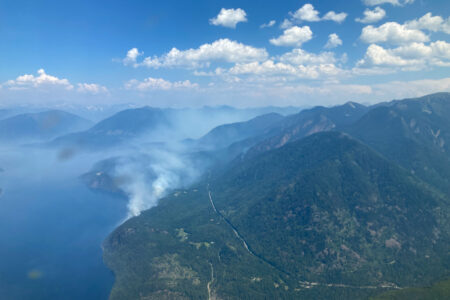
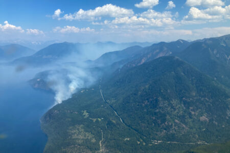
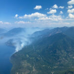
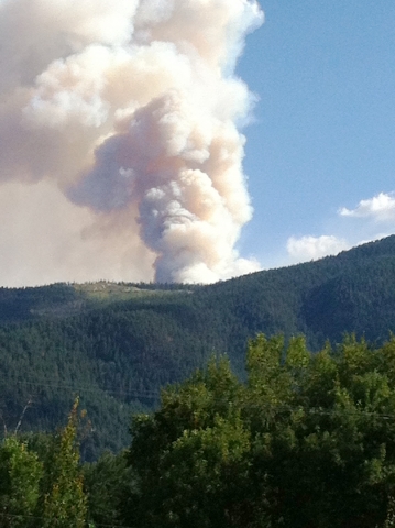
A fire burning south of the Boundary region in the United States is causing local residents concern as they see funnels of smoke and flames above their community.
The BC Wildfire Service says they are aware of the fire and that it is 6 km south of the Canadian border. However, their hands are tied until the fire passes the border into Canada.
“We don’t fight fires in the states,” said Melissa Klassen, a Fire Information Officer for the BC Wildfire Service, adding that they need to get invited into the United States before they can start fighing fires. “Our hands are tied.”
Klassen said that they are in constant communication with the United States about this fire and that they have plans in place if the fire does cross the border.
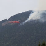
Currently, the fire is estimated to be 11,000 hectares and zero per cent under control. The with was blowing from the north – northeast, which should move the fire and smoke south and away from the Canadian border.
“So far it (the fire) has had a moderate rate of growth,” said Klassen.
The fire is called the “Stickpin” fire and is in the Colville National Park.
According to the United State’s Incident Information System, there are about 300 personnel working on the fire with more continuing to arrive. The west side of the fire is given the priority where firefighters are providing structure protection and trying to build fire lines.
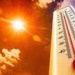
The wind is blowing 3 to 5 miles an hour and the forecast is warm and dry.
Evacuation alerts (not orders) are as follows:
LEVEL I (Be Ready):
Tonasket Creek RD, Aeneas Creek Road, Art Creek Road, Otis Road, St. Peters Creek, North Fork St. Peters Creek, Lambert, Wolfe Camp, Herron Creek, Fish Hatchery, Danville Area – HWY 21 all roads off the main hwy to mile marker 1 is LEVEL I. Danville-Curlew – HWY 21 all roads off the main HWY to mile marker 1 is LEVEL I. Lone Ranch – HWY 21 to mile marker 1 is LEVEL I. Boulder Creek-Deer Creek – HWY 21 to mile marker 1 is LEVEL I. Long Alec – HWY 21 to mile marker 1 is LEVEL I.
LEVEL II (Leave Soon):
Hurl Burt, Boulder Creek-Deer Creek – HWY 21 past mile marker 1 is LEVEL II, Long Alec – HWY 21 past mile marker 1 is LEVEL II, Danville Area – HWY 21 all roads off the main hwy past mile marker 1 is LEVEL II, Lone Ranch – HWY 21 past mile marker 1 is LEVEL II
LEVEL III (Leave Immediately): Currently NO Evacuation but can change at any time
All of these LEVEL’s include any roads off of the main road.