Kettle River Q&A – What is sediment and what does it mean for the Kettle River?
Raging, brown water carrying homes, cars, and boulders downstream: these images from the flooding last week in Alberta and southeastern BC have haunted me the last few days.
That brown stuff in those waters, sediment, is worth contemplating in the Kettle River and its tributaries. I’m picking on it today because it has been increasing in recent years.
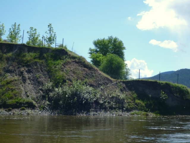
Sediment is a good indicator of watershed health as it responds to changes in land management and disturbance. It is also associated with other water quality issues, and strategies to reduce erosion would help improve many other aspects of surface water quality.
Sediment is a naturally-occurring material broken down by erosion from ice, wind, or water. It ranges in particle size from less than a micrometre (0.000039 inches) for clay mud to greater than 256 mm (10 inches) for boulders.
Fine sediment (clay, silt, and fine sand) can be carried easily in stream currents as suspended sediment. It can be measured by filtering water or estimated by examining the scatter of light, or cloudiness, in water. This is called turbidity.
Increases in suspended sediment can degrade fish spawning areas and directly harm fish, mussels, and aquatic invertebrates. Spawning gravels can become ‘clogged’ with silt, reducing oxygen and clean water flow for developing eggs. Fine sediment can also irritate fish gills and cause mussels to stop feeding.
Sediment often carries other pollutants (nutrients, heavy metals, and bacteria), and makes it harder to treat drinking water from surface sources.
There was a small but statistically significant increase in fine sediment (turbidity) between 1990 and 2008 at the Canada-BC water quality monitoring station at Midway. Between 2000 and 2008, counts of fecal coliform bacteria also increased significantly and are above water quality guidelines for drinking water.
Larger sand, gravel, cobble and boulders that are moved during higher flows are called ‘bedload’. Bedload moves slowly through river systems, often taking decades to move from landslides through river valleys.
Increased bedload can raise the elevation of the river bed (aggradation) and fill in deep pools needed by fish. It also leads to widening and braiding of the river channel, causing more loss of property and roads along the river.
We don’t have measurements of coarse sediments in our rivers, but recent observations of erosion, braiding and widening channels on the Granby River suggest increased bedload and aggradation. It will require further studies to see how the Granby has changed and how landscape changes have contributed.
Future columns will look at natural and human-caused sources of sediment in the watershed and potential solutions for reducing erosion that will be considered for the watershed management plan.
— Graham Watt is the coordinator of the Kettle River Watershed Management Plan for the RDKB, and is working with a Stakeholder Advisory Group from across the region to develop the plan. Email plan@kettleriver.ca


