Avalanche risks shifting with new snow
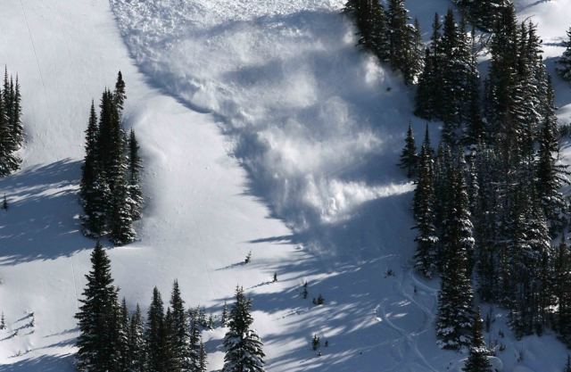
Avalanche risks are climbing as new snow and wind change up the stability of the snowpack, says the Canadian Avalanche Centre. Predicting continued flurries with wind through Tuesday, one of the Centre’s forecasters, James Floyer, says that a widespread cycle of small avalanches (size 1) have occurred in the most recent storm snow. Loose and slab avalanche activity was reported, with crowns up to 30 centimetres (cm) deep on all aspects and at all elevations. Explosive testing was able to produce slab avalanches to size 2, he added. All slopes are showing storm slabs and the north, northeast and southeast slopes also have wind slabs making the risk of avalanche considerable to high. Floyer recommends to:
- Avoid all avalanche terrain during periods of heavy loading from new snow, wind, or rain.
- Make observations and assess conditions continually as you travel.
- Choose conservative lines and watch for clues of instability.
- Avoid freshly wind loaded features.
“Total seven-day storm amounts have been in the region of 60-100 cm and this has now settled into storm slabs around 30 -60cm thick. The primary layer of concern in the snowpack is the upper interface with the dense new snow and the low density old storm snow (down 20 cm or so),” Floyer explained. “While not yet deep enough to result in large avalanches, this layer has been readily producing slab avalanches, which will increase in size as more storm snow arrives. The second layer of concern is a crust at the base of the old storm snow (down 50 cm or so) that exists below around 1900 metres. The bond with this crust appears to be quite good, however, on steep slopes this could easily act as a weak interface, potentially creating a layer for avalanches that initiate in the upper snow to step down to.”
For more information go to: Canadian Avalanche Centre.


