The Boundary Region
The Boundary is in the southern interior of British Columbia and incorporates the heritage valleys of the Kettle River, the West Kettle River, Boundary Creek, Granby River, Christina Lake and all of the many tributaries that drain the Monashee Mountains into the Columbia River Basin.
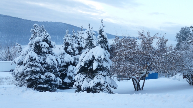
The Boundary is rich in natural unspoiled environment, and outdoor adventures include mountain biking, camping, fishing, hiking, and snowmobiling. Lakes, rivers, and streams are mostly unrestricted for water recreation. Every season provides plenty of opportunities, from golfing in the summer to skiing in the winter.
The region rose to prominence during the early 1900’s when it became the most important copper-producing region in the British Commonwealth. Today, forestry is the largest industry sector. Mining, quarrying and mining related industry, tourism and agriculture contribute substantially to the local economy.
The ethnic mix in the Boundary is varied, and a large number of area residents are of Doukhobor heritage. The influence of the Russian Doukhobor over the century is evident in many aspects of life, from agriculture to architecture to cuisine. New residents, ranging from young families to early retirees, are attracted to the area by the natural beauty of the lakes, rivers, and mountains, the beautiful towns, the mild climate, the strong community spirit, and the advantages of living in a rural environment.
The Doukhobors (spirit wrestlers) were a group of Russian religious pacifists who emigrated to Canada in 1898-99 with the assistance of writer Leo Tolstoy and British and American Quakers. As the Boundary district was well suited to cattle ranching and agriculture, the Doukhobors found the pastoral serenity around Greenwood, Grand Forks, and Castlegar compatible with their values of respect for the land and peaceful self-sufficiency.
A series of major and minor gold rushes began at Rock Creek in 1859 and throughout the area over the next 10 years, and saw the sudden influx of more than 5,000 miners, most of whom were from the U.S. Governor James Douglas quickly ordered the rapid construction of the now-famous Dewdney Trail, going from the coast to the gold field just north of the border. When bigger strikes occurred in the Okanagan and the Cariboo, the miners left, but an important trade route remained.
Location: The Boundary region is located immediately north of the Canada/United States border (Washington State), extending from the Anarchist Summit of Anarchist Mountain, east of Osoyoos, to Christina Lake. Over half a million travellers pass through Boundary Creek annually, with access from the east and west along the Crowsnest Highway 3, and from Kelowna and the Okanagan Valley in the north by Highway 33 at Rock Creek.
Boundary Links
Boundary Country Regional Chamber of Commerce
Regional District of the Kootenay Boundary (RDKB)
Grand Forks & District Public Library
Christina Lake Chamber of Commerce
-
West Boundary
The West Boundary area of Boundary country includes the small communities of Bridesville, Gold Canyon, Beaverdell, West Bridge, and Big White.
-
Rock Creek
The once flourishing gold and silver mining boomtown of Rock Creek is now a small community of 300 residents, with an economy based on agriculture, forestry and ranching. Some of the finest blue ribbon livestock in British Columbia is raised in Rock Creek and the surrounding area.
-
Midway
Situated on the broad Kettle River Valley, the small and peaceful village of Midway is one of the great places to visit in the Boundary, with many historical sites, numerous recreational centres, good camping facilities, and countless fascinating attractions.
-
Kettle Valley
The Kettle Valley’s Highway 33 follows the old Kettle Valley Railway grade as it links Kelowna with Rock Creek, an area that includes the Kettle River Provincial Recreation Area and the Kettle Valley Railway Trail. Remains of this early mining history are abundant, and a backroad trip to a ghost town will colour your visit to this extremely beautiful region.
-
Greenwood
Rich in historic charm, the story of Greenwood dates back to the discovery of rich lodes of copper-gold ore by prospectors in 1891. The dreams of Robert Wood came true, when in 1895 he purchased the land that is now the site of the city, built a General Store, and named the settlement Greenwood. With the discovery of rich copper ore came an influx of people from far and wide, and within two years the former rugged wilderness region had been transformed into a booming frontier city, one of the busiest and richest mining regions in Canada. Greenwood had become the social and economic hub of the entire Boundary region. -
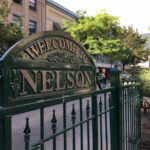
Grand Forks
The attractive town of Grand Forks is named for its location near the convergence of the Kettle and Granby Rivers, overlooked by Observation Mountain to the north and the aptly named Rattlesnake Mountain to the east. Kootenai Indians made their home in the Grand Forks Valley and Christina Lake area long before the settlement of European fur traders in 1865, as evidenced by pictographs and artifacts discovered. -
Christina Lake
Known as the Oasis of the Kootenays, Christina Lake is one of the best family holiday destinations in Canada. Located 20 kilometres east of Grand Forks, and 70 km southwest of Castlegar, the resort town of Christina Lake is spread along the lakeshore, and offers some of the best summer weather in British Columbia.
- See the best of the area on The Okanagan and BC Rockies Circle Tour. Travel the sunny interior of British Columbia, north through the Okanagan to Sicamous, following Highway 1 into the mountains of the BC Rockies. From Golden, head south through the Columbia Valley to Creston, and west through the Boundary and the Southern Okanagan to complete the loop. Circle Tours in BC.